![]() This information is unsuited for any regulatory
purpose. It shall not be used for any such purpose or
action, nor shall these reports and accompanying maps be
the basis for any determination relating to impact
assesment or mitigation.
This information is unsuited for any regulatory
purpose. It shall not be used for any such purpose or
action, nor shall these reports and accompanying maps be
the basis for any determination relating to impact
assesment or mitigation.
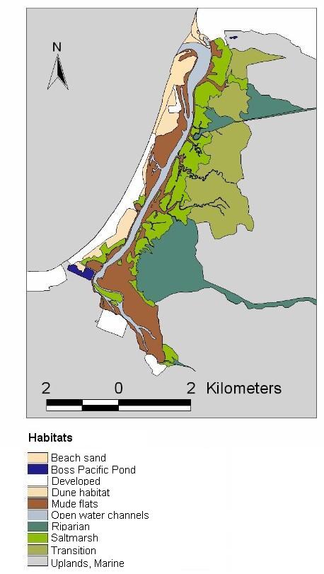
Source: The habitat map is a composite of two
datasets: infrared aerial photography from the
Chapultepec, Maneadero-La Bufadora zone (scale 1:20,000)
and aerial photography by Pro Esteros in 1989. The base
map was drawn and digitalized from a mosaic of 14
individual and georeferenced pictures of different parts
of the wetland, however Pro Esteros’ dataset
depicted the main and secondary channels and saltmarsh
very neatly so we digitalized these habitats on our base
map.
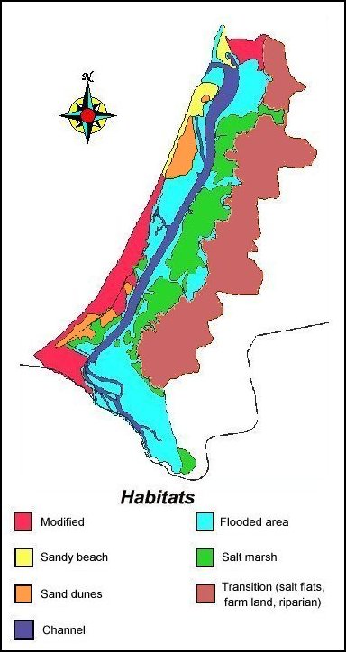
Source: Pro Esteros, Aerial Photography
Digitalized, Flight date 4 March 1989.