![]() This information is unsuited for any regulatory
purpose. It shall not be used for any such purpose or
action, nor shall these reports and accompanying maps be
the basis for any determination relating to impact
assesment or mitigation.
This information is unsuited for any regulatory
purpose. It shall not be used for any such purpose or
action, nor shall these reports and accompanying maps be
the basis for any determination relating to impact
assesment or mitigation.
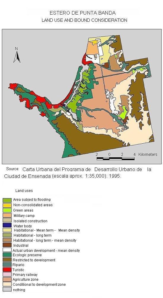
Source: The map Land Use and Designation was
digitalized the portion of Estero de Punta banda out of
the Urban Chart, of the Urban Development Program of the
City of Ensenada, B.C. (approx. scale 1:35,000). The
original map was provided by the Urban Development Office
of the City of Ensenada.