![]() This information is unsuited
for any regulatory purpose. It shall not be used for
any such purpose or action, nor shall these reports and
accompanying maps be the basis for any determination
relating to impact assesment or mitigation.
This information is unsuited
for any regulatory purpose. It shall not be used for
any such purpose or action, nor shall these reports and
accompanying maps be the basis for any determination
relating to impact assesment or mitigation.
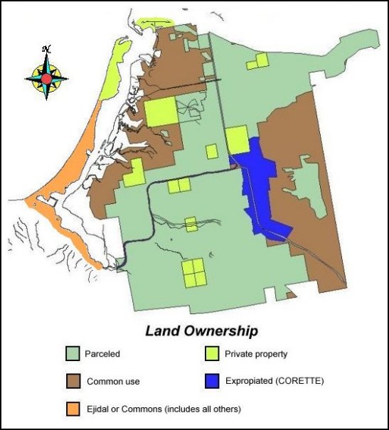
Source: This map of land ownership was composed
using arbitrary coodinates that were obtained at the
office of Registro Agrario Nacional in Mexicali, Baja
California. The coordinates were transformed to UTM
coordinates in order to draw "ejido" boundaries
in our base map. This map are not meant to constitute
wetland delineation of jurisdictional boundaries.