![]() This information is unsuited for any regulatory
purpose. It shall not be used for any such purpose or
action, nor shall these reports and accompanying maps be
the basis for any determination relating to impact
assesment or mitigation.
This information is unsuited for any regulatory
purpose. It shall not be used for any such purpose or
action, nor shall these reports and accompanying maps be
the basis for any determination relating to impact
assesment or mitigation.
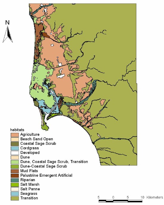
Source: the core of the information used for this map, was generated in 1995 under the leadership of DUMAC and Pro Esteros. The maps were obtained from Landsat TM satellite images (scale 1:50,000) following the classifcation of habitats developed by Ducks Unlimited and the map projection and quadrangles used by INEGI (Instituto Nacional Estadistica, Geografía e Informatica). We also included a scanned image of a former habitat map produced by Pro Esteros in 1990 out of aerial photography.
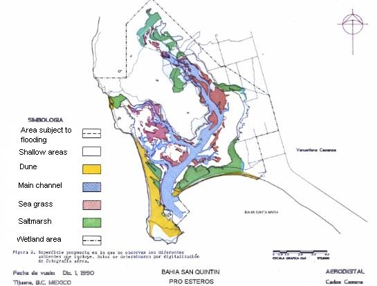
Source: Pro Esteros.